- CA ccg ccg-2053-is-ccg-city-74
- Item
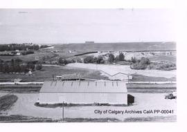
- 1960 July 12
Photoprint was taken in the Nose Creek Valley, between Memorial Drive and 8th Avenue NE; The area shown may now be part of Bottomlands Park; There is a rough tear in the surface of the photoprint
Land Department, City of Calgary, Alberta