Showing 27 results

Archival description
City of Calgary. Land Department fonds Environment and nature* With digital objects
Print preview View:

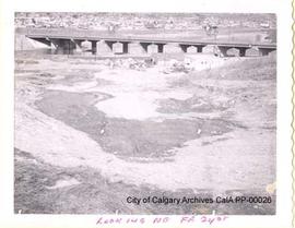
Aerial View of the Elbow River

Item consists of a hand-altered aerial-view photoprint of the Elbow River. Photoprint was taken of 2nd Street SE, on the south side of the Elbow river; The photoprint appears to be a image of another photoprint, which was altered by placing a drawing of a potential development over the existing landscape; The drawing appears to be of a parking lot and several small buildings (the buildings may not be drawn to scale); The land shown may have been owned by Lindsay Estate; This photoprint may have been taken as part of the plan to expropriate part of the Elbow Lodge Motor Hotel's parking lot in order to accommodate the realignment of the Victoria Bridge; The photoprint has been bent and rolled.

Bridge over the Bow River

Photoprint was taken at 24th Street and 10th Avenue SW; Plan 7436 GO; Block 5; Some of the construction area shown may now be part of the Shaganappi Point Golf Course; The surface of the photoprint is somewhat scuffed and fingerprinted; A small section of emulsion has flaked off in the lower right corner

Land Department, City of Calgary, Alberta

Chicken Coop

Located at 6 Street between 37th Avenue and 38th Avenue NE; M.L. Keylock was the original owner of the land. For further information, refer to the Land Department Inventory, Series III, Nose Creek Diversion; Fix stains are appearing on the photoprint; There are staple holes on the edges of the photoprint

JV Bull, Land Department, City of Calgary, Alberta

Houses in Nose Creek Valley

Photoprint was taken in Nose Creek Valley, between 8th Avenue and Memorial Drive NE; The area pictured may be Bridgeland or Bottomlands Park; The photoprint is slightly bent and has staple holes on the left edge

Land Department, City of Calgary, Alberta

Land in Southwest Calgary

Photoprint was taken in southwest Calgary at 1/4 Section 5-25-1-W5; The photoprint was taken as part of the Robertson Expropriation; There are fix stains on the bottom half of the photoprint

Land Department, City of Calgary, Alberta

Land in Southwest Calgary, Alberta

Photoprint was taken in southwest Calgary at 1/4 Section 5-25-1-W5; The photoprint was taken as part of the Robertson Expropriation; There are fix stains on the bottom half of the photoprint; The surface of the photoprint is somewhat rough

Land Department, City of Calgary, Alberta

Looking East at the Bow River Bridge

Photoprint was taken 10th Avenue and 24th Street SW; Plan 7436 GO; Block 5; looking east; Photoprint was taken as part of the City of Calgary's plan to create a 24th Street Expressway; The downtown skyline is also visible; The surface of the photoprint is pockmarked and fingerprinted; A series of white dots on the image appear to be flaws from the negative

Land Department, City of Calgary, Alberta

Looking South from 10th Avenue, 1968

Photoprint was taken at 10th Avenue and 24th Street SW Plan 7436 GO; Block 5; Photo was taken as part of the plan to create a 24th Street Expressway; The surface of the photoprint is somewhat rough; There is a series of white dots on the image, likely transferred from a flaw in the negative

Land Department, City of Calgary, Alberta

Looking SW from 10th Avenue

The photoprint was taken at 10th Avenue and 24th Street SW, looking south-west; The photoprint was taken as part of the City of Calgary's plan to create a 24th Street Expressway; The area shown may now be part of the Jacques Lodges residential complex and the Shaganappi Point Golf Course; The surface of the photoprint is somewhat rough and fingerprinted; Spots and fades in the photoprint may be the result of problems with the original exposure or damage to the negative

Land Department, City of Calgary, Alberta

Results 1 to 10 of 27